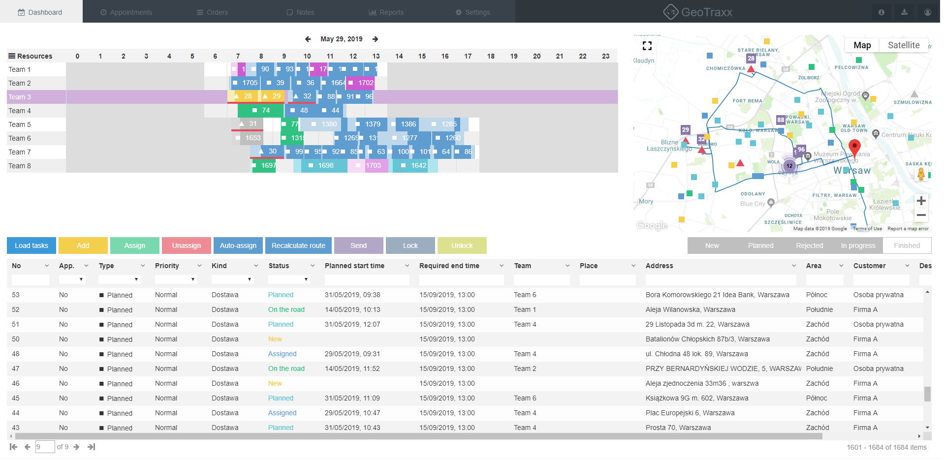
The dispatcher creates a delivery plan based on the list of orders. The plan is visualized on a timeline for each of the vehicles. The route and the vehicle’s current position are displayed on the map.
Learn more
Driver’s app
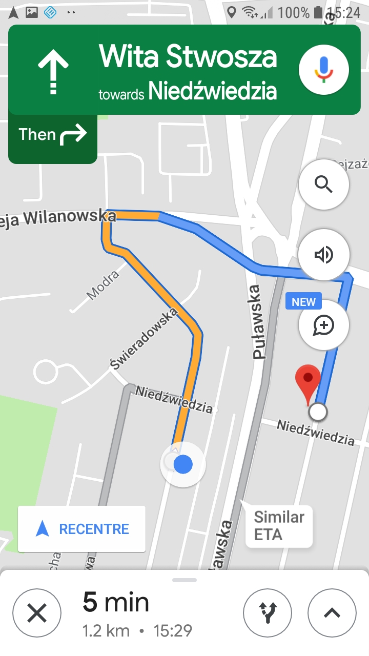
Each delivery route is arranged in an order of scheduled delivery stops. The application navigates the driver to the next delivery stop. The driver reports a finished task, so that the dispatcher can see the current status of the order.
Learn more
Automation of route planning- dispatcher’s app
GeoTraxx allows to quickly work out a transport plan based on maps and navigation data from Google. GeoTraxx algorithms make the delivery plan realistic, accurate, and effective. Vehicle type, its maximum capacity, size of a truck’s pallet space, driver’s working hours and traffic based on Google Maps data are some of the parameters considered in route planning.
Route planning
The dispatcher receives the finished delivery plan in a short time. It’s possible to visualize the expected arrival and unloading times. Such delivery plan can be modified manually and personalized.
Route optimization
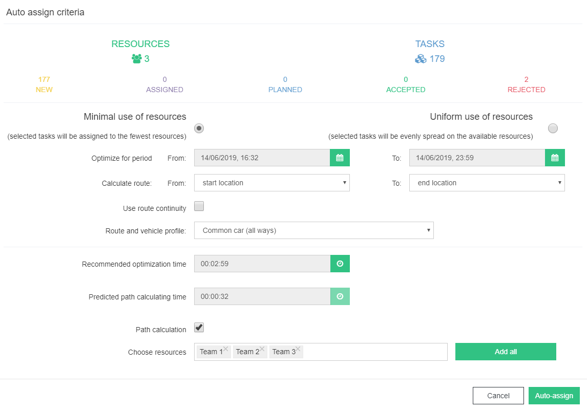
The dispatcher can choose an algorithm for the route planning: minimizing the resources usage or making the vehicle usage even. The optimization function helps to meet the delivery deadlines, avoid vehicles overloads, and minimize the route lengths.
Vehicle monitoring
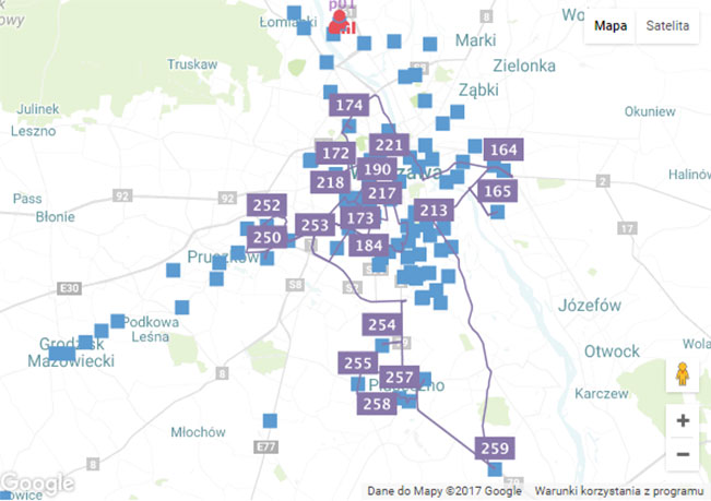
Delivery locations and current vehicle positions are presented on the map. The dispatcher is informed about the delivery status (map icons have different colors depending on the status). Employees’ actions, like driving or unloading the vehicle are marked with different icons and colors.
Punctual delivery time
The transport is planned in a way which ensures delivery is completed on time.
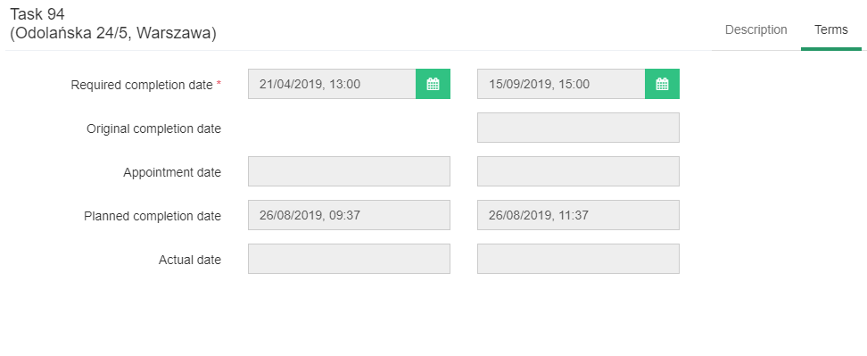
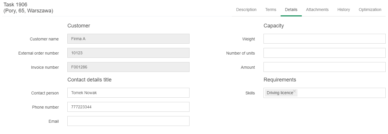
Task attributes
The necessary customer’s contact details are available in the task view.
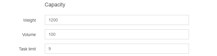
Vehicle attributes
The delivery order is assigned to a vehicle of an appropriate type and capacity.
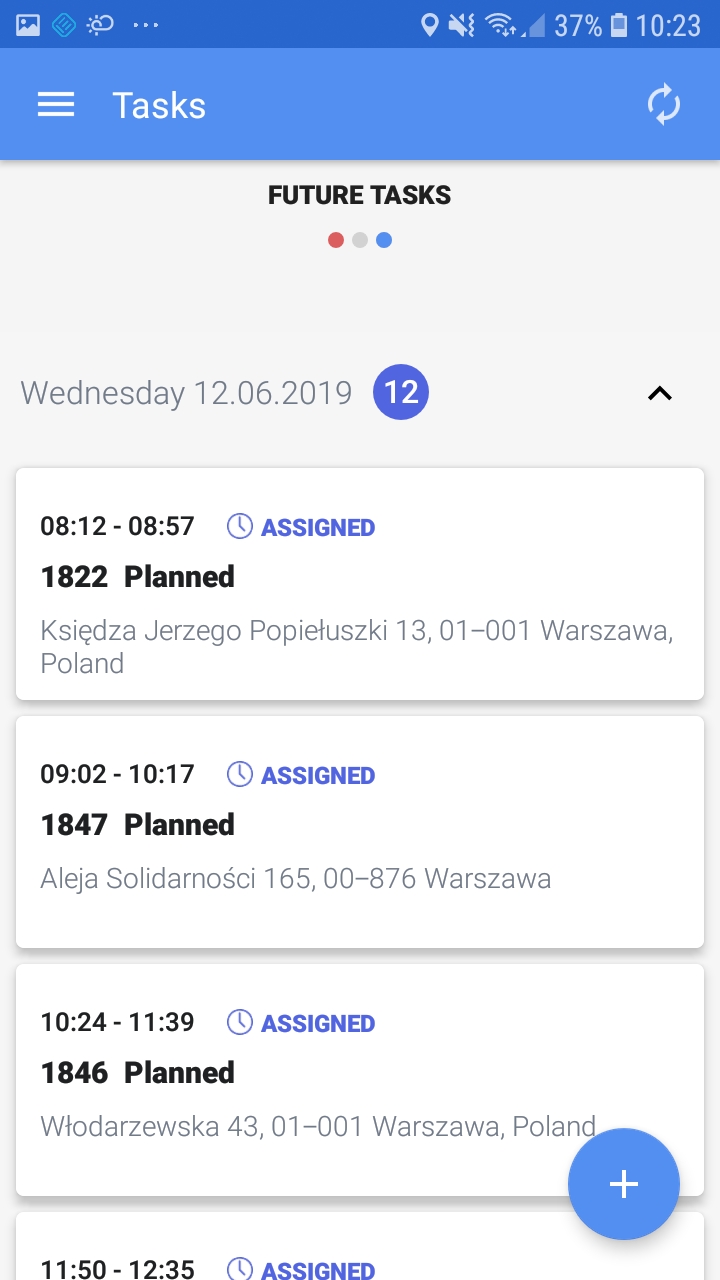
Delivery completion – driver’s app
The GeoTraxx Android based mobile application provides a list of orders arranged according to the route plan. The driver logs the delivery status, which allows monitoring process, register travel and unloading times, and current deliverer’s location. The application allows collecting additional data such as photos and forms.
Scheduled deliveries list
Tasks are presented as a list arranged in order of scheduled delivery stops. The driver can see their status: completed, in progress, or pending.
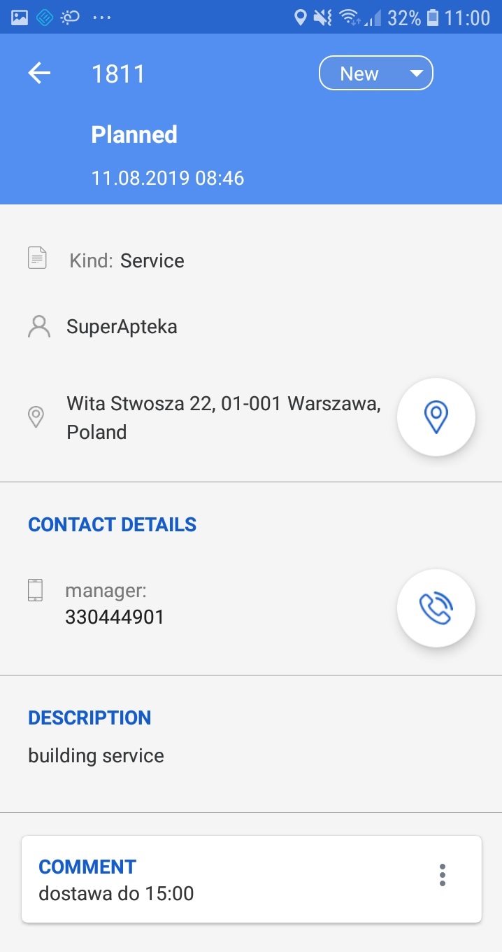
Details of the delivery order
The order’s details provide necessary information like addresses, delivery times, and recipients’ contact details.
Task functions
An order’s status is updated in the app. There is an option to attach data such as pictures taken with a smartphone, record voice memos, or using Google Maps navigation.

Navigation
The GeoTraxx application is integrated with Google Maps navigation that leads the driver to the next delivery address.